NASA Satellite Altimetry Confirms Intensifying 2026 'Super El Niño' Rivaling Historic 1997 Oceanic Heat Anomalies
Drawing on 35 years of continuous satellite ocean altimetry records, NASA Earth Observatory scientists issued a major global climate alert on Monday confirming that equatorial Pacific sea surface heights and thermal content have surged into rare 'Super El Niño' territory, portending severe winter weather extremes across North America.

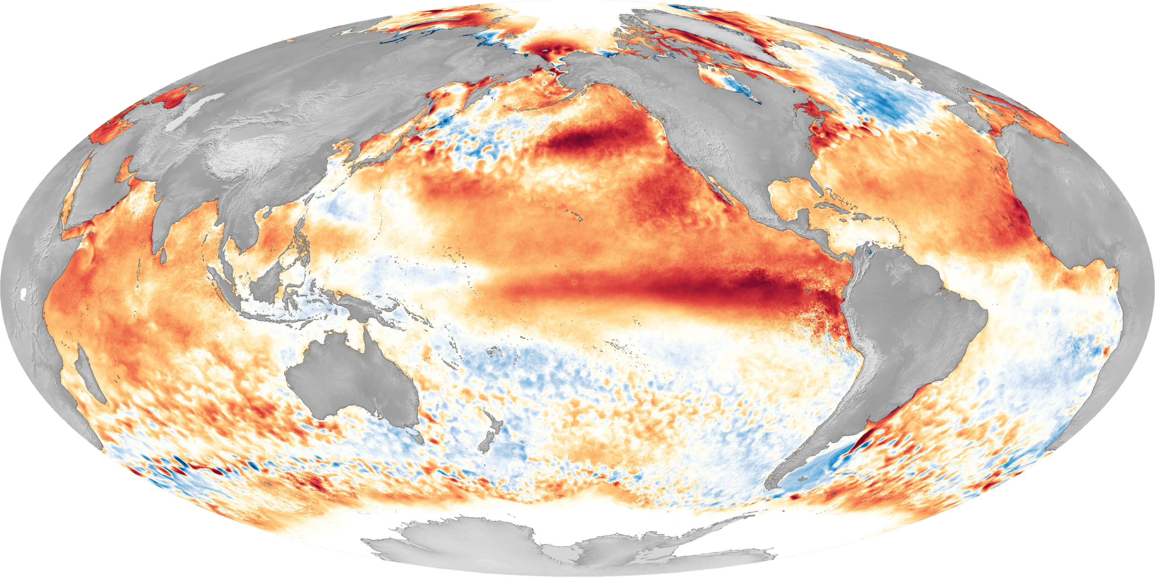
PASADENA, Calif. — Comprehensive satellite altimetry observations analyzed by NASA's Jet Propulsion Laboratory and the Earth Observatory confirm that an extraordinary warming phenomenon across the central and eastern equatorial Pacific has officially crossed into historic 'Super El Niño' territory. The oceanographic dataset, synthesized from the Sentinel-6 Michael Freilich, Jason-3, and TOPEX/Poseidon satellite records spanning 35 continuous years, indicates thermal sea surface height anomalies matching the devastating 1997–1998 and 2015–2016 climate anomalies.
According to NASA's ocean physics bulletin released Monday, sea level heights across thousands of square miles of the equatorial Pacific have expanded by more than eight inches above seasonal baselines—a direct consequence of deep ocean thermal expansion caused by the slackening and reversal of traditional easterly trade winds. Subsurface temperature sensors deployed through the international Argo float array recorded water temperatures between 3.5 and 4.2 degrees Celsius above normal down to depths of 200 meters.
'The scale and velocity of thermal accumulation we are tracking in the Pacific basin is virtually indistinguishable from the onset of the mega-El Niño of 1997,' stated Dr. Joshua Willis, senior oceanographer and climate scientist at JPL. 'This is not merely an elevated ocean temperature reading; it represents a colossal reservoir of thermal energy that is fundamentally reorganizing the global atmospheric jet stream as we head directly into the Northern Hemisphere winter season.'
The National Oceanic and Atmospheric Administration (NOAA) and the National Weather Service immediately updated their seasonal winter outlooks, warning of an amplified subtropical jet stream that will direct a relentless succession of moisture-laden atmospheric river storms into California, the Pacific Northwest, and across the Southern Tier of the United States through March 2027. Conversely, meteorological agencies across Australia, Indonesia, and southern Africa warned of severe agricultural drought and heightened bushfire risks.
Emergency management officials across California and the Gulf Coast have begun coordinating state-level flood mitigation and reservoir releases to buffer against catastrophic landslide and runoff hazards. Scientists noted that the 2026 event is particularly acute because background ocean heat content was already elevated following consecutive record-breaking global warmth years, creating unprecedented conditions for tropical cyclone intensification in the central Pacific.
Related Coverage

NASA Launches Global Countdown to Voyager 1’s Historic ‘One Light-Day’ Milestone From Earth
NASA announced worldwide celebrations as interstellar probe Voyager 1 nears 16.1 billion miles from Earth, while the Chandra X-ray Observatory uncovers a secret companion star driving violent deep-space eruptions.

NASA Launches $1 Million Student Moon Base Challenge and Releases Landmark Hubble Dark Matter Survey
NASA opened a major national competition inviting student engineering teams to design lunar South Pole life support systems, while releasing an extraordinary nine-panel Hubble deep-space survey mapping cosmic gravitational lenses.

NASA Opens Applications for New Astronaut Class Destined for Permanent Lunar Base and Mars Missions
NASA officially opened recruitment for its newest class of astronaut candidates, seeking STEM professionals to train for long-duration habitation at humanity's planned lunar outpost and future crewed voyages to Mars.